Winter Storm Conditions Possible Sunday-Monday
Interrupting your Friday afternoon to provide a little update on my expectations for the incoming period of snow + blustery winds forecast to impact our area on Sunday and Monday. A Winter Storm Watch remains in effect for Champaign County and surrounding portions of East-Central Illinois from 12 AM Sunday to 12 PM Monday. I’m guessing much of the area will be upgraded to either Winter Storm Warnings or Winter Weather Advisories by Saturday morning.
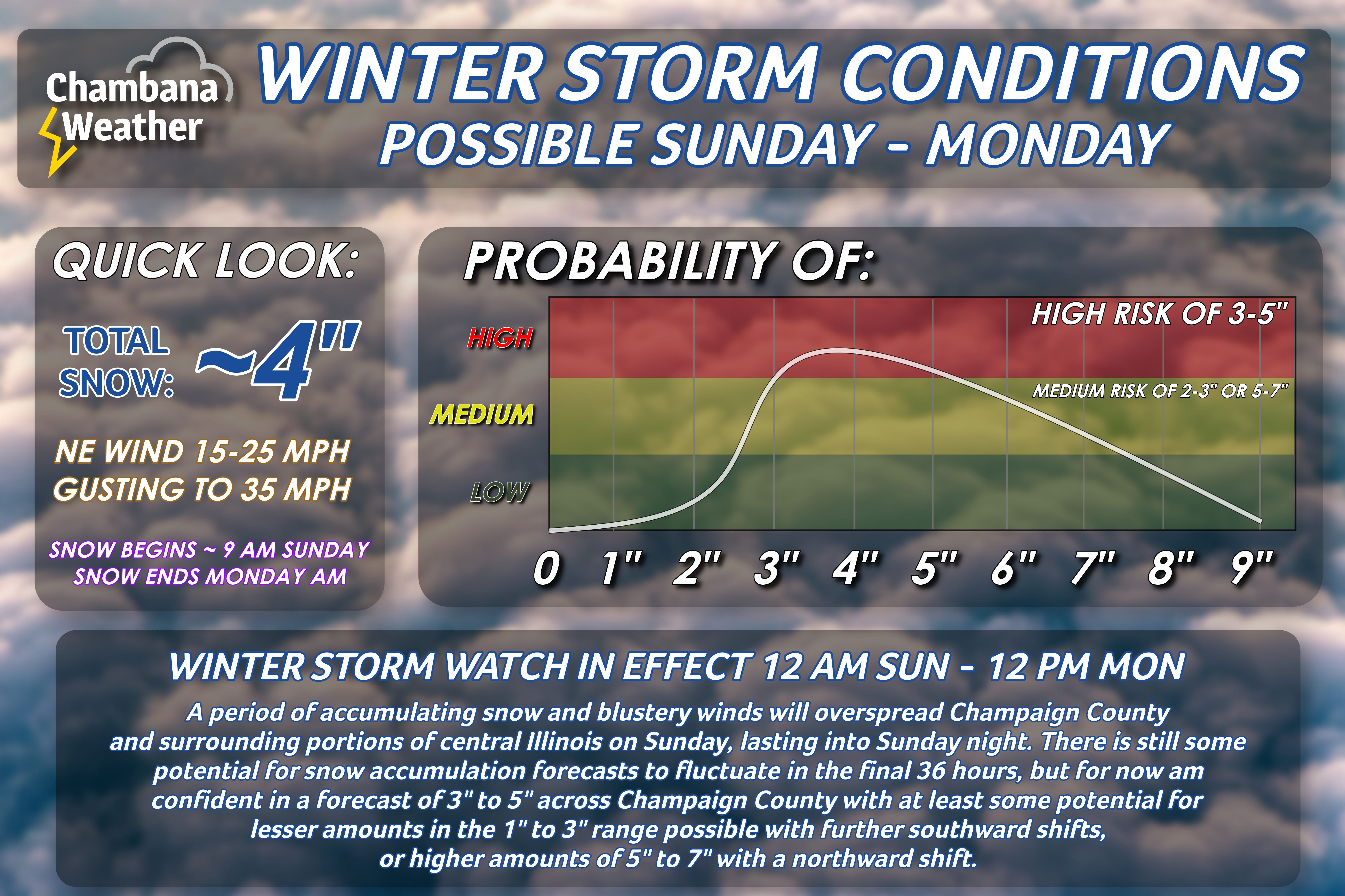
Snow should begin to spread across central Illinois on Sunday morning. Exact timing here is still a bit tricky but “around 9 AM” feels about right for now in Champaign County and surrounding areas. Heaviest snow probably moves through the area Sunday afternoon into the early overnight period. Northeasterly/northerly winds are the strongest Sunday evening into Sunday night. Snow tapers off on Monday morning, but gusty winds continue.
After seeing mid-day weather data, I feel reasonably confident in a snowfall forecast of between 3” to 5” across Champaign County by Monday morning - this includes the Champaign-Urbana metro. There is still some chance for higher totals in the 5”-7” range with a northerly shift in the storm track in the final 36 hours, or lesser totals in the 2”-3” range with a southerly shift. Still, I intentionally held off on discussing specific snow amounts until I felt confident in those amounts, and my gut is starting to lock on to “around 4” locally.
Impacts across central Illinois will probably be most severe Sunday afternoon through the morning hours on Monday when snow and wind gusts are at their peak. If you don’t have to be out and about on Sunday or Monday, I would start planning to not.