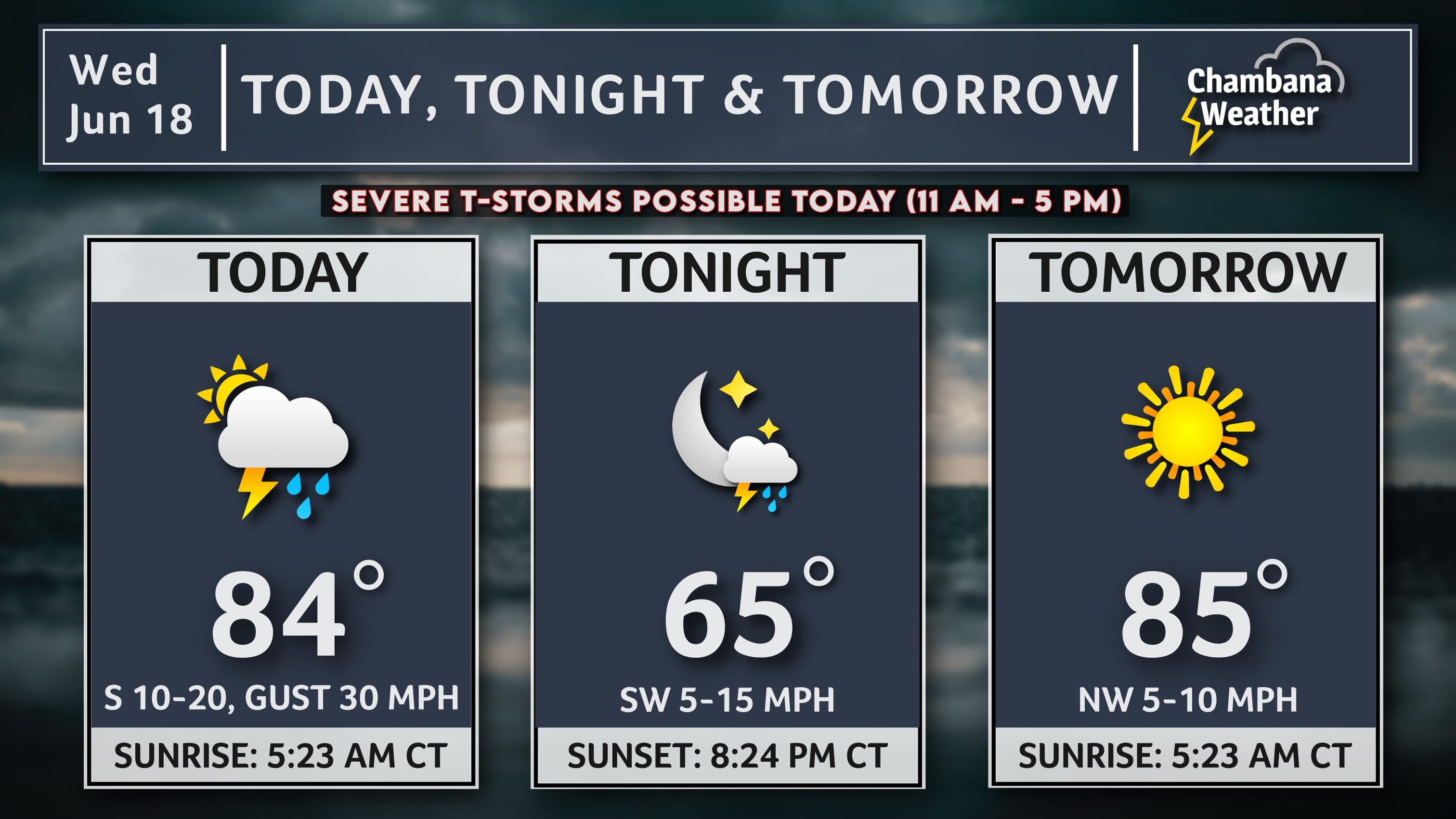
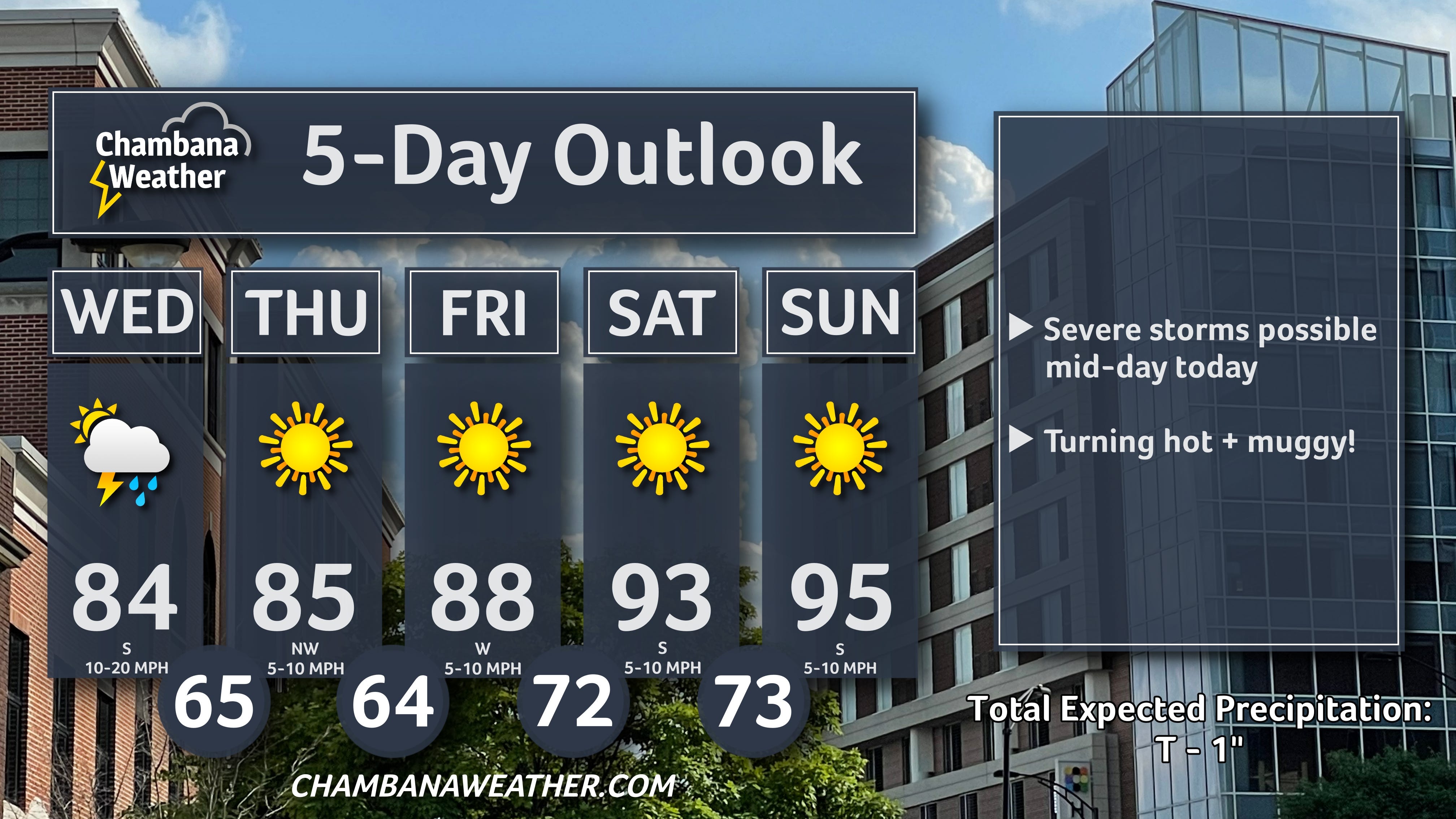
Daily Weather | Wed, June 18th, 2025
Here is your Champaign-Urbana Forecast from Chambana Weather Meteorologist Andrew Pritchard... For today, partly cloudy and breezy with thunderstorms likely and a high of 84 degrees. A few storms could become severe this afternoon. South wind 10 to 20 mph, gusting to 30 mph... Tonight, mostly cloudy with a chance of thunderstorms and a low of 65 degrees. Southwest wind 5 to 15 mph... Tomorrow, mostly sunny with a high of 85 degrees. Northwest wind 5 to 10 mph... Tomorrow night, clear skies with a low of 64 degrees. Northwest wind 5 mph... And for Friday, sunny with a high of 88 degrees. Southwest wind 5 to 10 mph.
Good Wednesday morning! We’ve got a bit of a severe weather risk locally today, beginning late morning and lasting into the afternoon hours. An area of low pressure will lift into central Illinois this morning, and scattered thunderstorms may begin to erupt ahead of it between 10 AM - 12 PM. The primary risk with any severe storms locally will be isolated tornadoes and wind gusts to 60 mph, with the most likely time frame for severe weather in the immediate Champaign County/east-central Illinois vicinity being focused between 11 AM - 3 PM today. The severe weather risk will fade this evening, but scattered showers and storms will remain possible into the overnight. We’ll turn sunny, hot, and humid heading into the weekend.