


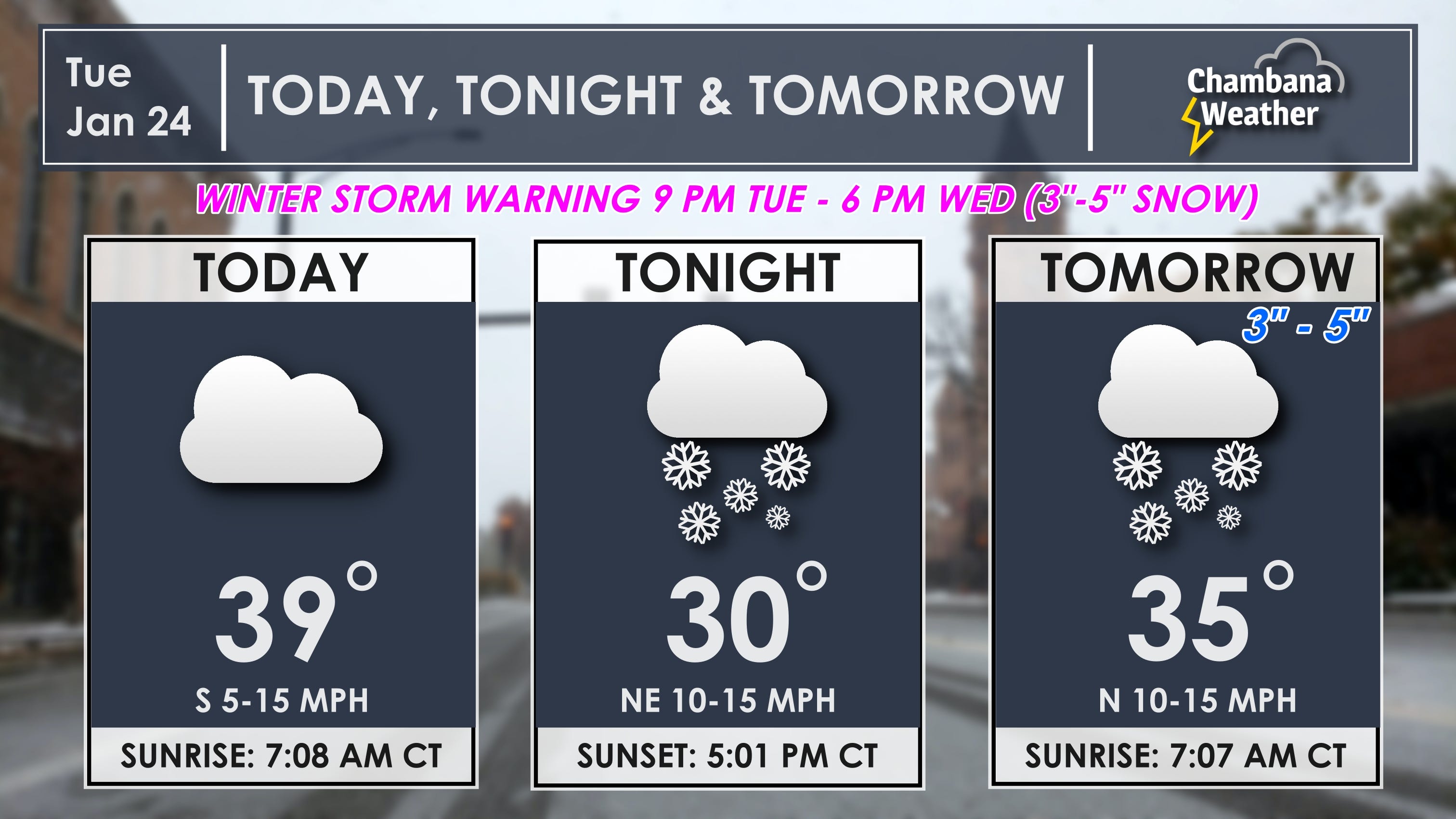
Daily Weather | Tue, Jan 24th, 2023 (Winter Storm Warning)
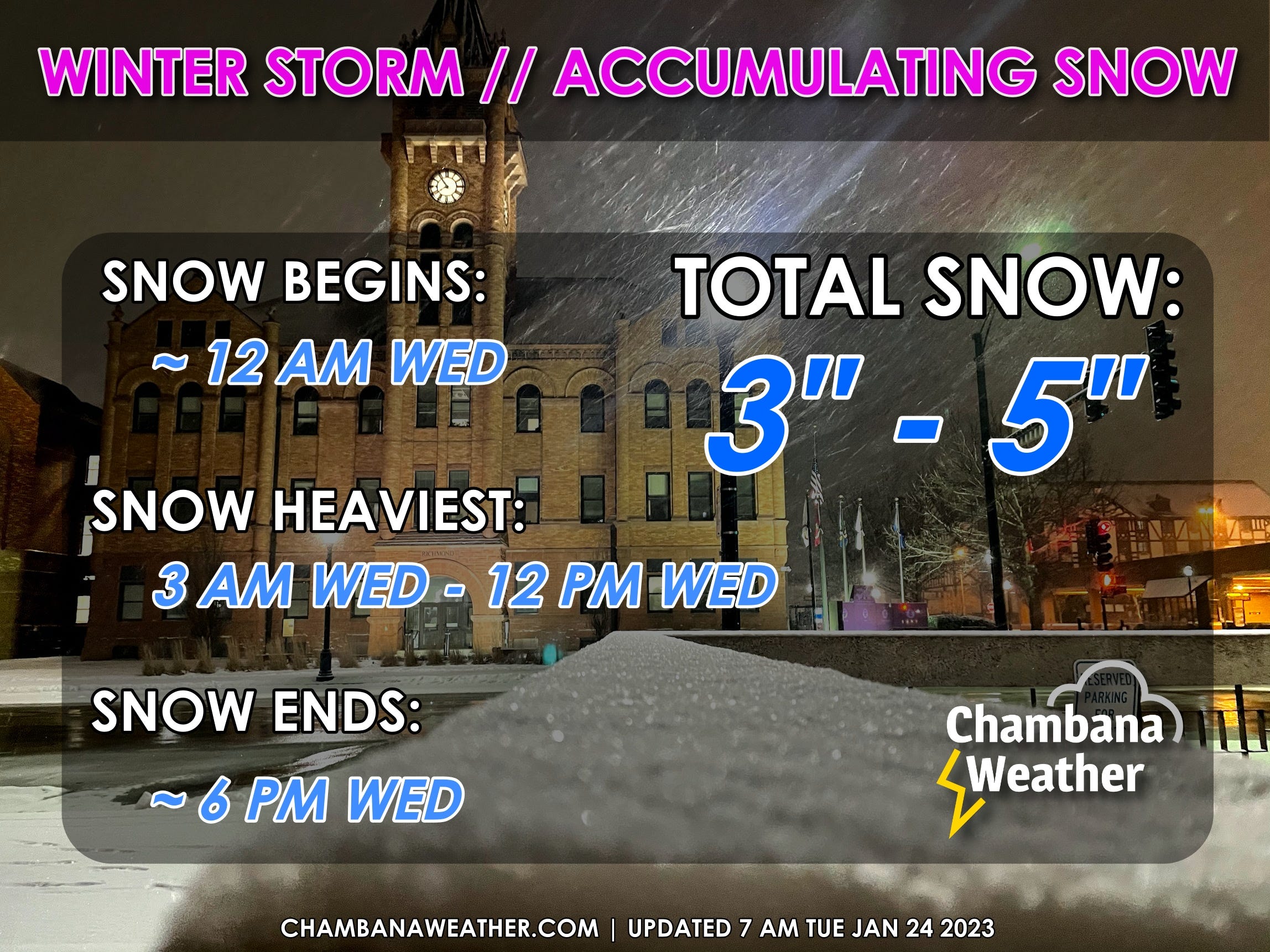
A WINTER STORM WARNING GOES INTO EFFECT AT 9 PM TUESDAY AND LASTS UNTIL 6 PM WEDNESDAY.
Here is your Champaign-Urbana Forecast from Chambana Weather Meteorologist Andrew Pritchard... For today, mostly cloudy with a high of 38 degrees. South wind 5 to 10 mph... Tonight, cloudy with snow likely after Midnight and a low of 31 degrees. East wind 5 to 15 mph... Tomorrow, cloudy with snow likely and a high of 34 degrees. Snow may be heavy at times during the morning. East wind 5 to 15 mph. Total snow accumulation of 3 to 5 inches possible... Tomorrow night, cloudy with a low of 27 degrees. Northwest wind 10 to 20 mph... And for Thursday, cloudy with a chance of flurries and a high of 31 degrees. Northwest wind 10 to 15 mph.
Good Tuesday morning! A Winter Storm Warning goes into effect at 9 PM tonight, lasting through the day tomorrow. Here's my abbreviated take on the snow... Expect snow to begin falling across Champaign County around Midnight, perhaps a little later. Snow continues, becoming heavy at times during the morning on Wednesday. Snow will initially battle above-freezing ground temperatures, leading to some melting as snow falls. Still, I'm expecting between 3" to 5" of snow to accumulate across Champaign County and surrounding portions of east-central Illinois, with locally higher amounts possible. Snow flurries are possible into Thursday, though no additional accumulation is expected.
The slightly longer take:
A WINTER STORM WARNING goes into effect at 9 PM Tuesday and lasts until 6 PM Wednesday. In Champaign County, I expect snow to begin falling very close to Midnight on Tuesday night/Wednesday morning. Snow becomes heaviest during the morning hours on Wednesday. Initially, snow will battle above-freezing ground temperatures leading to some melting as snow falls. Still, total accumulation of around 3" to 5" with locally higher amounts is expected across Champaign County and surrounding portions of east-central Illinois. Winds of 15 to 20 mph won't lead to much in the way of blowing & drifting but could still exacerbate low visibility during periods of heavy snowfall. With warmer ground temperatures it's possible that roadways are slushy vs icy and snow covered, but travel may still be difficult through the day on Wednesday while heavy snow falls. Flurries are possible on Thursday with no additional accumulation anticipated.