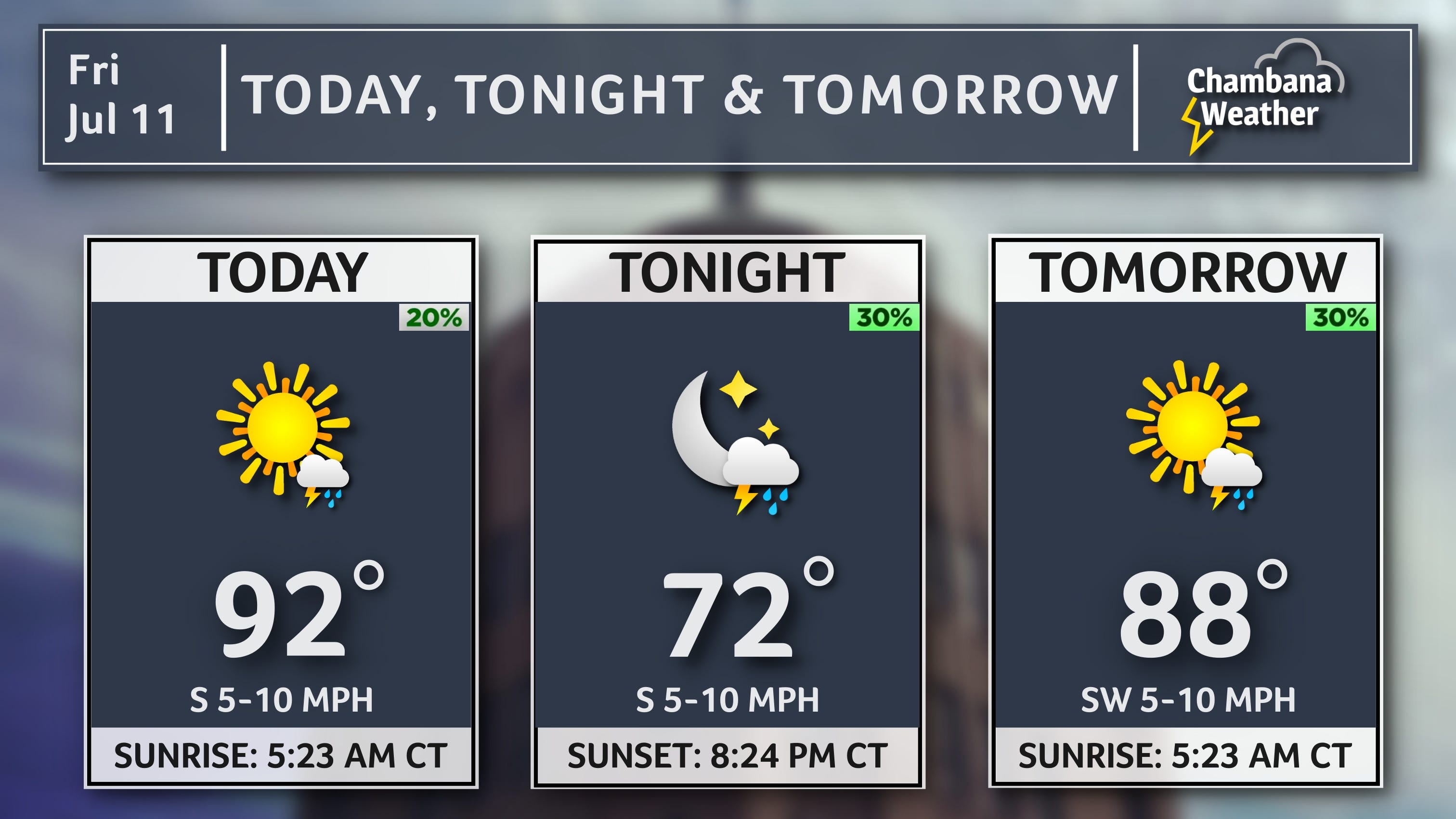
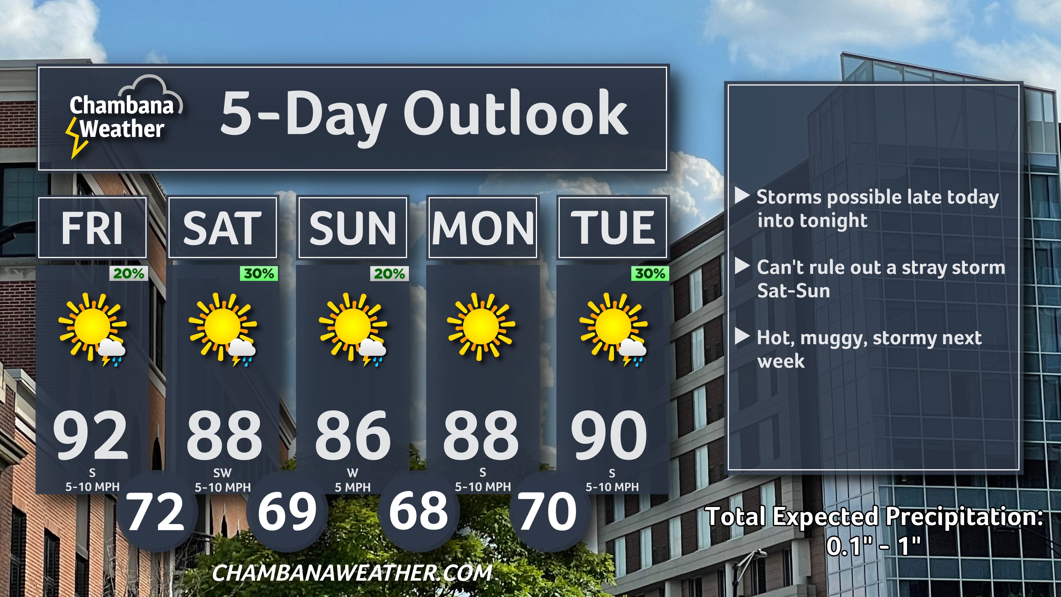
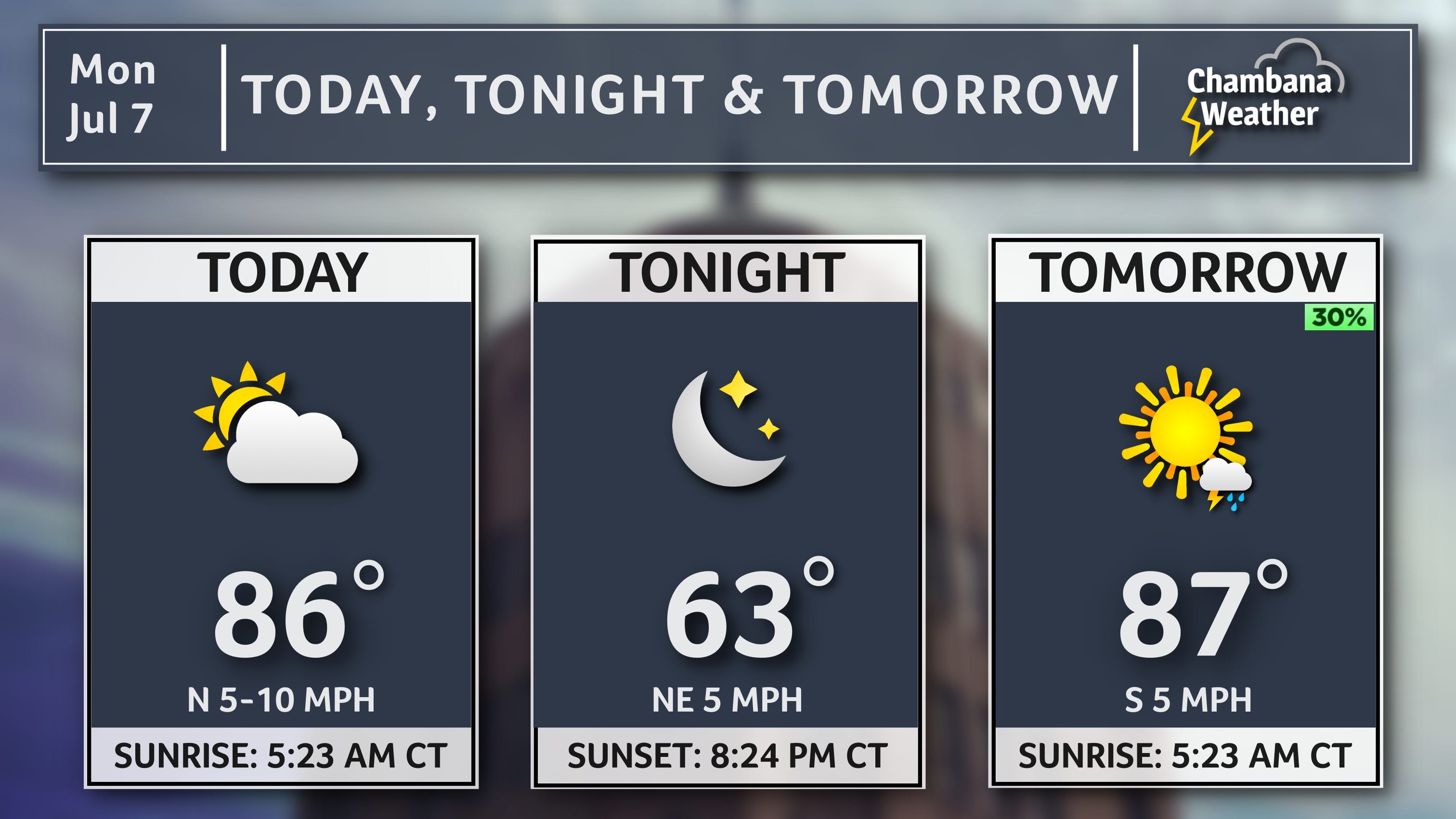
Here is your Champaign-Urbana Forecast from Chambana Weather Meteorologist Andrew Pritchard... For today, mostly sunny with a chance of a thunderstorm late in the day and a high of 92 degrees. South wind 5 to 15 mph... Tonight, partly cloudy with a chance of thunderstorms and a low of 72 degrees. South wind 5 to 10 mph... Tomorrow, partly cloudy with a chance of a thunderstorm and a high of 88 degrees. Southwest wind 10 mph... Tomorrow night, mostly cloudy with a low of 69 degrees. West wind 5 to 10 mph... And for Sunday, mostly sunny with a chance of a thunderstorm and a high of 86 degrees. Northwest wind 5 mph.
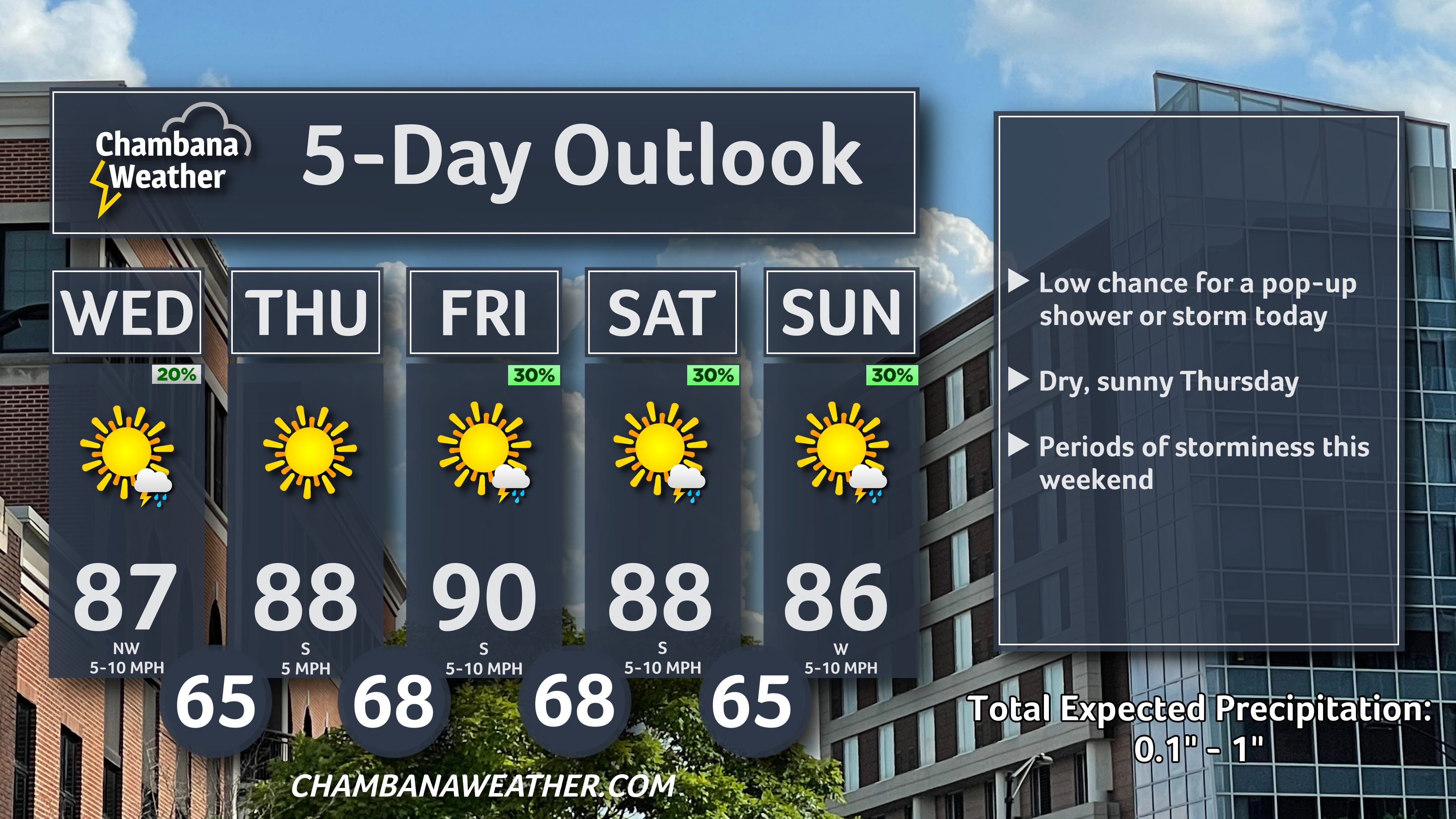
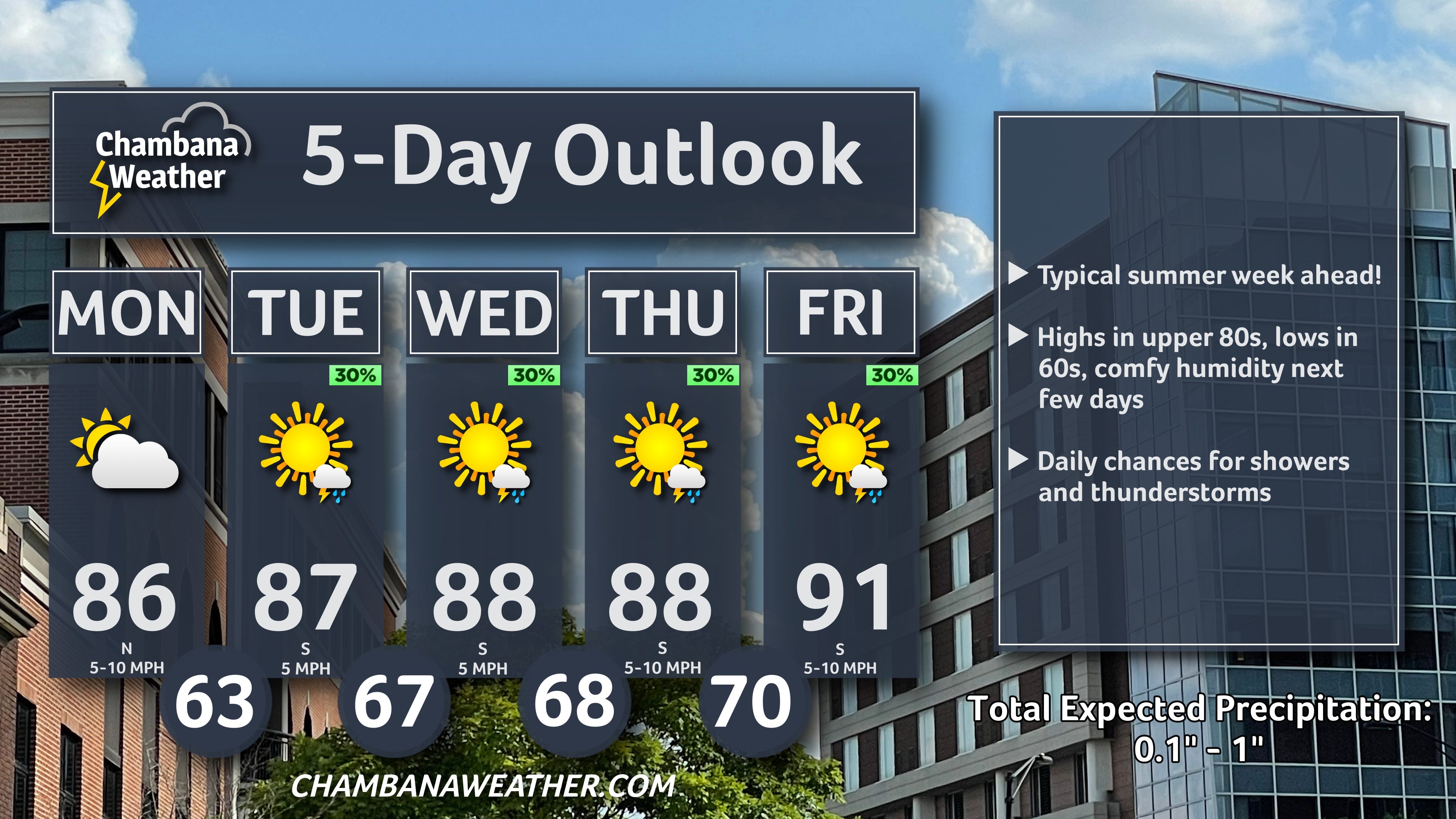
TGIF! We’re looking at a hot, sunny, and muggy Friday with a low chance for thunderstorms increasing late today into the overnight hours. Can’t rule out a stray storm on Saturday or Sunday, with a hot, muggy, at-time-stormy pattern continuing into next week.
I’ll be on vacation with the family next week - I’ll relay any critical weather information related to heat/storms as needed but will be pausing morning forecast emails Monday - Thursday, July 14-17. Thanks for understanding!